Handley Gardens by Taylor Wimpey · 8 Stirling Close, Maldon, Essex CM9 6GS
Under construction
Taylor Wimpey has 252 developments on Homello. Homes in Maldon sold for a median £375,000 over the last year, £402 per sq ft; see house prices in Maldon.
About Handley Gardens
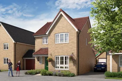
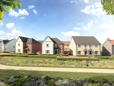
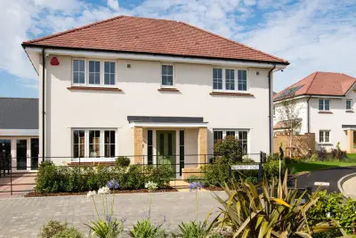
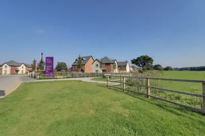
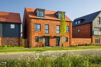
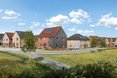
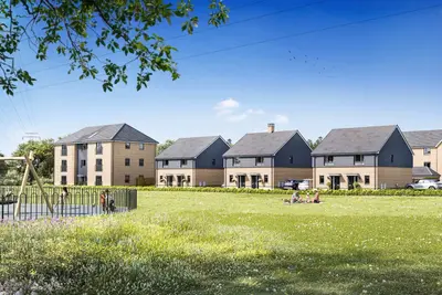
Handley Gardens is a new build residential development by Taylor Wimpey, located at 8 Stirling Close, Maldon, Essex, CM9 6GS. The scheme is part of a wider, master-planned neighbourhood known as Limebrook Park, adhering to modern ‘garden suburb principles’. The development features a balanced mix of property types, with the current Phase 4 offering 2, 3, 4, and 5-bedroom houses, alongside select 2 and 3-bedroom bungalows.
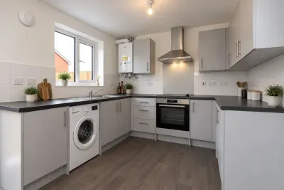
All houses in Phase 4 are sold Freehold, while apartments from earlier phases are Leasehold. The site is designed to create a vibrant community with an emphasis on integrated green space, play areas, and scenic walkways. Handley Gardens will eventually bring approximately 1,000 new homes to the area. Taylor Wimpey holds a 5-star customer satisfaction rating from the Home Builders Federation, though prospective buyers should note third-party reviews indicate varying experiences with build quality and aftercare on some national developments. Properties currently available range in size and style. For first-time buyers and downsizers, the 3-bedroom semi-detached The Byford (approx. For growing families, 4-bedroom detached homes, such as The Midford (approx. 1170 sq ft) and The Trusdale (approx. Standard specifications include a neutral décor palette, contemporary fitted kitchens, and in larger homes, a separate utility room and garage. Sustainability features are incorporated into the design, including solar panels, heat recovery systems, and provision for EV charging. Specific plots may include a detached garage, a turfed garden, and an upgraded specification package. Handley Gardens is situated on the south side of the historic maritime town of Maldon, offering access to its charming high street and estuary location. For leisure, residents benefit from proximity to Promenade Park and the Blackwater Estuary National Nature Reserve. Transport Links: Maldon itself does not have a train station, but commuter links are established via nearby stations. The closest major train connections are at Witham or Chelmsford, both reachable via local bus services. A typical combined journey to London Liverpool Street (including the bus link to the station) takes approximately 1 hour 19 minutes to 1 hour 23 minutes. By car, the development offers good access to the A12 via the A414 or B1019. Local bus routes, including the 332, 333, and 75, provide connectivity to the town centre, Chelmsford, and Witham. Local Amenities and Education: The site is well-located for families, with Wentworth Primary School approximately 0.4 miles away and All Saints Maldon Church of England Primary School at 0.7 miles. Secondary education is served by Plume Academy, which is rated ‘Good’ by Ofsted. The final development masterplan includes provisions for a new primary school, two early years/childcare facilities, and a local centre with potential for shops and a pub, ensuring amenities are integrated into the community. A choice of major supermarkets is available in the Maldon area. The development is in Phase 4, with various homes available for immediate move-in or with completion dates projected for late 2025. Estate management fees apply to the properties (e.g.52 per annum for The Trusdale house type). Interested parties should contact the Taylor Wimpey sales executive at the Stirling Close sales office to confirm current availability, specific plot EPC ratings (some are 'A' rated), and current incentive packages.
- Developer
- Taylor Wimpey
- City
- Essex
- Neighbourhood
- Maldon
- Postcode
- CM9 6GS
- Address
- 8 Stirling Close, Maldon, Essex
- Bedrooms
- 2–5
- Total homes
- 2
- Tenure
- For sale
Questions about Handley Gardens
›Who is the developer of Handley Gardens?
Handley Gardens is a Taylor Wimpey development in Maldon, Essex. Taylor Wimpey has 252 developments listed on Homello.
›Is Handley Gardens still selling?
Handley Gardens is marked "now selling", under construction. Use the enquiry button to check current availability with Taylor Wimpey.
›What are house prices like in Maldon?
The median sold price in Maldon was £375,000 over the last 12 months (486 sales, −2.6% on the year before), or £402 per square foot, from HM Land Registry data. The house prices in Maldon page has the trend, prices by property type and every street.
›What type of homes are at Handley Gardens?
Handley Gardens offers houses, 2–5 bedroom homes, 2 homes in total. Homes are sold outright by Taylor Wimpey.
Location
8 Stirling Close, Maldon, Essex, CM9 6GS
Nearest stations
- North Fambridge Station 4.7 milesGreater Anglia
- South Woodham Ferrers Station 5.5 milesGreater Anglia
- Hatfield Peverel Station 5.6 milesGreater Anglia
- Althorne Station 5.8 milesGreater Anglia
Nearest schools
- Limebrook Primary School and Nursery 0.4 milesPrimary · ages 2–11
- Wentworth Primary School 0.4 milesPrimary · ages 4–11 Good
- Maldon Primary School 0.9 milesPrimary · ages 4–11
- Plume School 0.9 milesSecondary · ages 11–18
Nearest supermarkets
- Morrisons Large supermarket 0.5 miles
- The Co-operative Food Convenience store 0.7 miles
- Marks and Spencer Simply Food Supermarket 1.0 miles
- Iceland Supermarket 1.0 miles
Eating out nearby
Within half a mile: 1 pub or bar, 1 takeaway.
- The Royal Oak 0.4 milesPub or bar
- Golden Sand 0.4 milesTakeaway
- Cafe 1989 0.5 milesRestaurant or cafe
- Kitchen Cafe 0.5 milesRestaurant or cafe
Straight-line distances; actual routes will be longer. Stations from NaPTAN, with their lines powered by TfL Open Data; schools from the Department for Education register, with the latest Ofsted signal; supermarkets from Geolytix Retail Points; places to eat from the Food Standards Agency's register of food businesses.
Area insights
The Maldon neighbourhood around this development.
Sources: HM Land Registry price paid data, Police.uk, Historic England, ONS Census 2021, Ofcom Connected Nations, Environment Agency. Planning offices.

We have not been able to confirm current prices here recently.
Checked on the Taylor Wimpey website on 28 October 2026.