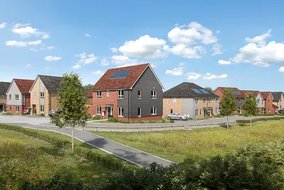
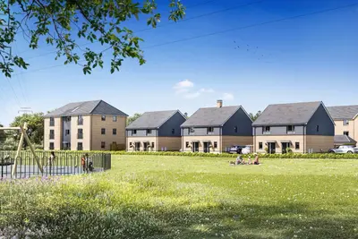
Duncarnock by Taylor Wimpey · off Springfield Road, Barrhead, East Renfrewshire G78 2SG
Taylor Wimpey has 252 developments on Homello.
About Duncarnock
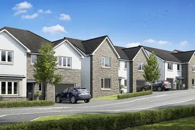
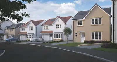
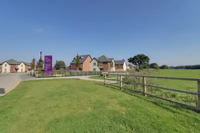
Duncarnock is a new build homes development by Taylor Wimpey West Scotland, located off Springfield Road in Barrhead, East Renfrewshire (G78 2SG). The development is situated on the edge of the Gleniffer Braes and forms part of the Barrhead South Masterplan, which includes provisions for local transport upgrades and a potential new railway station. This masterplan is designed to benefit the wider community and enhance the local infrastructure.
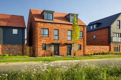
The available properties comprise a selection of two, three, four, and five-bedroom homes, designed to cater to a range of buyers from first-time owners to growing families. The Duncarnock development offers a mix of semi-detached and detached new build homes. For two-bedroom buyers, the 'Andrew' house type (e.g., Plot 188) is a semi-detached property featuring a lounge-diner with French doors to the rear garden, a separate contemporary kitchen, and a downstairs cloakroom. For larger requirements, four-bedroom detached styles include 'The Douglas' (1,117 sq ft) and 'The Hume' (e.g., Plot 51). 'The Hume' layout typically features a separate dining room, a spacious lounge, an additional family room, and a kitchen/diner with French doors. Upstairs, this house type offers multiple en-suite facilities, including a private en-suite to Bedroom 1 and a Jack & Jill en-suite shared between bedrooms two and three. All properties are constructed to current new build standards and feature energy-efficient solutions, including PV solar panels, contributing to reduced household running costs. Each new home is backed by a 10-year NHBC structural warranty and a 2-year Taylor Wimpey customer care warranty. Barrhead offers strong transport links for commuters, with Barrhead train station providing rail services to Glasgow Central. The fastest journey time to Glasgow Central is approximately 12 minutes, with a typical average journey time of 19 minutes. The development's location near Springfield Road also provides good access to the regional road network, including the nearby M77 motorway. Duncarnock is located within the East Renfrewshire Council area, which is highly regarded for its educational provision. Specific schools within proximity include Hillview Primary School (0.4 miles), St Luke's High School (0.4 miles, located on Springfield Road), and Barrhead High School (1.1 miles). Local amenities are readily accessible, including a Tesco Superstore (0.9 miles) and Barrhead Retail Park (1 mile). For leisure and retail, Silverburn Shopping Centre is located approximately 3.1 miles away, while the Dams to Darnley Country Park offers significant local green space and heritage trails. Duncarnock is an ongoing development, with various phases of construction and completion scheduled. Taylor Wimpey, a major national housebuilder, offers buying assistance schemes at this development, including Easymover and the Own New Rate Reducer, subject to terms and eligibility. Specific availability, plot completion dates, and viewing arrangements for the show homes (such as the Douglas style) should be confirmed by direct contact with the Taylor Wimpey sales office at the Duncarnock site on Springfield Road. The development will also contribute 25 homes for social rent, managed by Barrhead Housing Association.
- Developer
- Taylor Wimpey
- City
- East Renfrewshire
- Neighbourhood
- Barrhead
- Postcode
- G78 2SG
- Address
- off Springfield Road, Barrhead, East Renfrewshire
- Total homes
- 138
- Tenure
- For sale
Questions about Duncarnock
›Who is the developer of Duncarnock?
Duncarnock is a Taylor Wimpey development in Barrhead, East Renfrewshire. Taylor Wimpey has 252 developments listed on Homello.
›What type of homes are at Duncarnock?
Duncarnock offers houses, 138 homes in total. Homes are sold outright by Taylor Wimpey.
Location
off Springfield Road, Barrhead, East Renfrewshire, G78 2SG
Nearest stations
- Balgray Station 0.2 miles
- Barrhead Station 1.1 milesScotRail
- Neilston Station 1.6 milesScotRail
- Nitshill Station 1.9 milesScotRail
Nearest schools
- Bowness-on-Solway Primary School 73.9 milesPrimary · ages 3–11
- Silloth Primary School 74.7 milesPrimary · ages 3–11 Outstanding
- Solway Community School 74.7 milesSecondary · ages 11–16
- Holme St Cuthbert School 78.2 milesPrimary · ages 4–11 Good
Nearest supermarkets
- The Co-operative Food Convenience store 0.6 miles
- Tesco Large supermarket 0.8 miles
- Iceland Supermarket 0.8 miles
- Farmfoods Supermarket 0.9 miles
Eating out nearby
Within half a mile: 1 takeaway.
- Golden Chopstix 0.4 milesTakeaway
- Flavaurs Drive 0.6 milesTakeaway
- Cafe Aurs 0.6 milesRestaurant or cafe
- Canton House 0.8 milesRestaurant or cafe
Straight-line distances; actual routes will be longer. Stations from NaPTAN, with their lines powered by TfL Open Data; schools from the Department for Education register, with the latest Ofsted signal; supermarkets from Geolytix Retail Points; places to eat from the Food Standards Agency's register of food businesses.
Area insights
The neighbourhood around this development.
Sources: HM Land Registry price paid data, Police.uk, Historic England, ONS Census 2021, Ofcom Connected Nations, Environment Agency. Planning offices.

We have not been able to confirm current prices here recently.