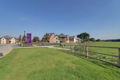
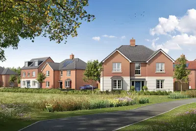
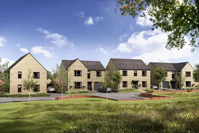
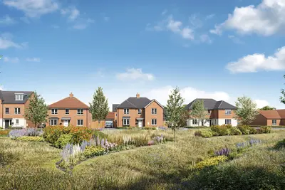
Charnwood Chase at Swinfen Vale by Taylor Wimpey · Charnwood Chase, Sence Valley Road (off Beveridge Lane), Coalville, Leicestershire LE67 1HU
Under construction
Taylor Wimpey has 252 developments on Homello. Homes in Coalville sold for a median £250,000 over the last year, £263 per sq ft; see house prices in Coalville.
About Charnwood Chase at Swinfen Vale
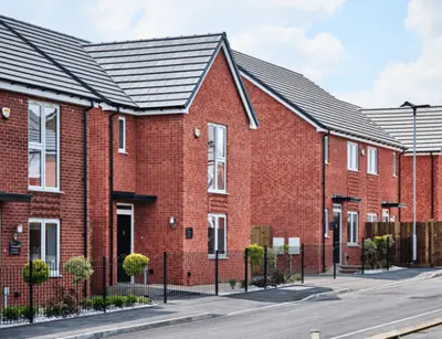
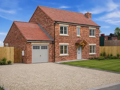
Charnwood Chase at Swinfen Vale is a new build development by Taylor Wimpey in Coalville, Leicestershire (LE67 1HU). The sales address is Charnwood Chase, Sence Valley Road (off Beveridge Lane). Taylor Wimpey publishes prices from £234,950 to £449,950 for this development.
Availability and prices are read from Taylor Wimpey's own website (taylorwimpey.co.uk) and were last checked on 2026-09-04. Viewings and reservations are handled by the developer's sales team, and the plots listed on this page change as homes are released and sold.
- Developer
- Taylor Wimpey
- City
- Leicestershire
- Neighbourhood
- Coalville
- Postcode
- LE67 1HU
- Address
- Charnwood Chase, Sence Valley Road (off Beveridge Lane), Coalville, Leicestershire
- Tenure
- For sale
Questions about Charnwood Chase at Swinfen Vale
›Who is the developer of Charnwood Chase at Swinfen Vale?
Charnwood Chase at Swinfen Vale is a Taylor Wimpey development in Coalville, Leicestershire. Taylor Wimpey has 252 developments listed on Homello.
›How much do homes at Charnwood Chase at Swinfen Vale cost?
Prices at Charnwood Chase at Swinfen Vale start from £234,950.
›Is Charnwood Chase at Swinfen Vale still selling?
Charnwood Chase at Swinfen Vale is marked "now selling", under construction. Use the enquiry button to check current availability with Taylor Wimpey.
›What are house prices like in Coalville?
The median sold price in Coalville was £250,000 over the last 12 months (771 sales, −3.8% on the year before), or £263 per square foot, from HM Land Registry data. The house prices in Coalville page has the trend, prices by property type and every street.
Location
Charnwood Chase, Sence Valley Road (off Beveridge Lane), Coalville, Leicestershire, LE67 1HU
Nearest schools
- Greenstone Primary School <0.1 milesPrimary · ages 4–11
- Ellistown Community Primary School 0.7 milesPrimary · ages 4–11 Good
- Hugglescote Community Primary School 1.2 milesPrimary · ages 4–11
- The Newbridge School 1.3 milesSecondary · ages 11–16
Nearest supermarkets
- Aldi Supermarket 0.1 miles
- Asda Express Convenience store 0.7 miles
- Budgens Convenience store 0.8 miles
- Morrisons Daily Convenience store 1.2 miles
Eating out nearby
Within half a mile: 1 restaurant or cafe.
- Baxterstorey Ltd At Amazon Distribution Centre 0.2 milesRestaurant or cafe
- Baxter Storey At Laddaw 0.6 milesRestaurant or cafe
- Ellistown Fish & Chips 0.7 milesTakeaway
- Phat Bellies Cafe 0.8 milesRestaurant or cafe
Straight-line distances; actual routes will be longer. Stations from NaPTAN, with their lines powered by TfL Open Data; schools from the Department for Education register, with the latest Ofsted signal; supermarkets from Geolytix Retail Points; places to eat from the Food Standards Agency's register of food businesses.
Area insights
The North West Leicestershire neighbourhood around this development.
Sources: HM Land Registry price paid data, Police.uk, Historic England, ONS Census 2021, Ofcom Connected Nations, Environment Agency. Planning offices.

Register for launch pricing and availability.
Checked on the Taylor Wimpey website on 21 October 2026.