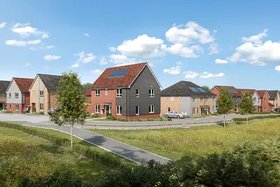
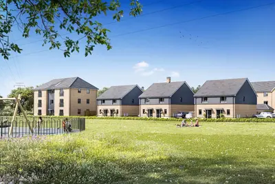
Burdon Fields by Taylor Wimpey · Buttonwood Road, Ryhope, Tyne and Wear SR3 2YX
Taylor Wimpey has 252 developments on Homello. Homes in Sunderland sold for a median £155,000 over the last year, £177 per sq ft; see house prices in Sunderland.
About Burdon Fields
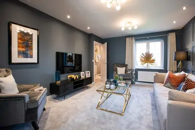
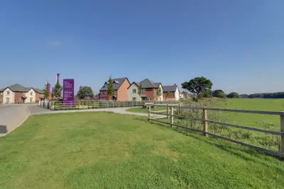
Burdon Fields is a new build development by national housebuilder Taylor Wimpey, located on Buttonwood Road in the coastal village of Ryhope, Tyne and Wear, SR3 2YX. The development is planned to comprise 193 thoughtfully designed homes, offering a mix of property types intended to appeal to a range of buyers from first-time homeowners to growing families. The location provides a blend of village life with direct access to major urban centres.
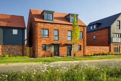
Initial phases of the development include two, three, and four-bedroom homes. Pricing for the four-bedroom detached house types is available upon request from the sales centre. The design of Burdon Fields has been developed to harmonise with the existing local architecture while incorporating modern design and energy efficiency standards. The properties at Burdon Fields are designed with a focus on sustainability and energy performance. Standard specifications across the development include PV solar panels, triple glazed windows, and dedicated electric vehicle charging points, which contribute to lower running costs and a reduced environmental footprint. The current house mix available features terraced and semi-detached units. The two-bedroom 'Beaford' model is offered in both terraced and end-of-terrace configurations (e.g.Purchasers seeking larger detached homes should contact the developer for specific details on available four-bedroom layouts. Burdon Fields is positioned to benefit from local amenities and regional transport infrastructure. The development is situated near the heart of Ryhope Village, with local bus stops, such as 'The Village', being within a short walking distance (approximately 2 minutes). Transport Links: Direct Go North East bus routes, including services 60, 63, and 22, operate frequently from Ryhope into Sunderland city centre, with a journey time of approximately 8 minutes. For travel to Newcastle upon Tyne, a combined bus and Tyne and Wear Metro journey (via Sunderland Interchange) typically takes between 46 and 55 minutes. Driving provides access to Newcastle in approximately 21 minutes (15.3 miles). The location offers close proximity to the A1018, facilitating road travel across the Tyne and Wear area. Local Amenities and Education: Ryhope supports established local educational institutions. These include Ryhope Infant School Academy and Ryhope Junior School. The Junior School was recognised by Ofsted in March 2022, with its Leadership and Management rated as 'Outstanding'. Furthermore, the area is set to benefit from the proposed establishment of an early years satellite site for Sunningdale Primary School, located near the Ryhope Infant and Junior Schools. The Ryhope Village centre provides immediate local shops and services, with the wider range of retail, dining, and leisure facilities available within the nearby city of Sunderland. Four-bedroom property pricing is available by application. Potential buyers should note that final plot completion dates, specific fixtures and fittings, and any available incentives (such as Part Exchange options mentioned in some listings) should be confirmed directly with the Taylor Wimpey Burdon Fields sales team. Viewings of show homes and the overall site status are subject to developer-specific arrangements; contact the developer for details regarding current availability and appointment scheduling.
- Developer
- Taylor Wimpey
- City
- Tyne and Wear
- Neighbourhood
- Ryhope
- Postcode
- SR3 2YX
- Address
- Buttonwood Road, Ryhope, Tyne and Wear
- Total homes
- 193
- Tenure
- For sale
Questions about Burdon Fields
›Who is the developer of Burdon Fields?
Burdon Fields is a Taylor Wimpey development in Ryhope, Tyne and Wear. Taylor Wimpey has 252 developments listed on Homello.
›What are house prices like in Sunderland?
The median sold price in Sunderland was £155,000 over the last 12 months (1,766 sales, −4.9% on the year before), or £177 per square foot, from HM Land Registry data. The house prices in Sunderland page has the trend, prices by property type and every street.
›What type of homes are at Burdon Fields?
Burdon Fields offers houses, 193 homes in total. Homes are sold outright by Taylor Wimpey.
Location
Buttonwood Road, Ryhope, Tyne and Wear, SR3 2YX
Nearest stations
- Seaham Station 2.5 milesNorthern
- Park Lane Station 2.7 milesTyne and Wear Metro
- University Station 2.7 milesTyne and Wear Metro
- Sunderland Station 2.9 milesGrand Central, Northern · Tyne and Wear Metro
Nearest schools
- Mill Hill Nursery School 0.5 milesNursery · ages 2–5 Good
- Mill Hill Primary School 0.5 milesPrimary · ages 5–11 Good
- St Leonard's Catholic Primary School, Silksworth 0.7 milesPrimary · ages 5–11 Good
- New Silksworth Academy Junior 0.8 milesPrimary · ages 7–11 Good
Nearest supermarkets
- Aldi Supermarket 0.8 miles
- Morrisons Superstore 1.0 miles
- Iceland Supermarket 1.0 miles
- Asda Supermarket Supermarket 1.1 miles
Eating out nearby
- Gills Golden Fish N Chips 0.6 milesTakeaway
- Silksworth W M C 0.6 milesPub or bar
- Aunt Maud's Tasty Dinners 0.7 milesTakeaway
- Green Bamboo 0.7 milesTakeaway
Straight-line distances; actual routes will be longer. Stations from NaPTAN, with their lines powered by TfL Open Data; schools from the Department for Education register, with the latest Ofsted signal; supermarkets from Geolytix Retail Points; places to eat from the Food Standards Agency's register of food businesses.
Area insights
The Sunderland neighbourhood around this development.
Sources: HM Land Registry price paid data, Police.uk, Historic England, ONS Census 2021, Ofcom Connected Nations, Environment Agency. Planning offices.

We have not been able to confirm current prices here recently.
Checked on the Taylor Wimpey website on 28 October 2026.