Boorley Park, Boorley Green by Linden Homes · Boorley Park, Boorley Green, Botley, Hampshire SO32 2UA
Linden Homes has 75 developments on Homello. Homes in Southampton sold for a median £305,000 over the last year, £345 per sq ft; see house prices in Southampton.
About Boorley Park, Boorley Green
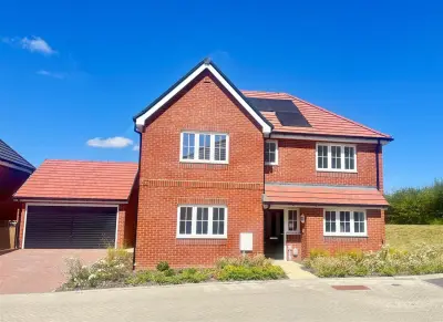
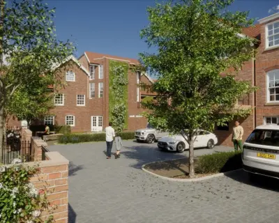
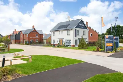
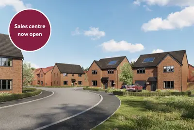
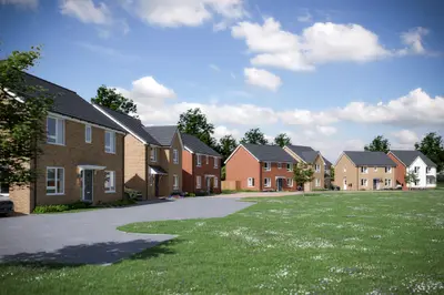
Development Overview Boorley Park, developed by Linden Homes (part of Vistry Southern), is a new build homes community situated in Boorley Green, Botley, Hampshire (SO32 2UA), just over a mile from Botley village. The development offers a selection of energy-efficient new build houses ranging from two to five bedrooms. Currently, it is nearing completion, with only a FINAL FEW HOMES REMAINING for sale.
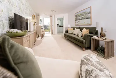
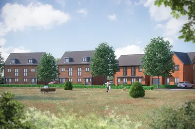
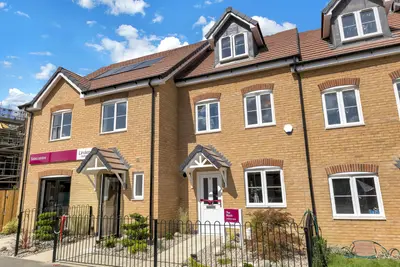
Interested buyers should note that the Sales Centre is now closed and all visits are by appointment only. Property Details These new build homes are designed for modern living, boasting an indicative EPC B rating. Each home comes with a 10-year NHBC 'Buildmark' warranty and a 2-year customer care guarantee. Specific property styles like 'The Haywood' are three-storey town houses, featuring a downstairs cloakroom, a spacious open-plan living/dining room with French doors to the garden, a separate kitchen, and a private master bedroom with an en-suite on the top floor, along with dedicated single garage and driveway parking. Location and Transport Links Boorley Park is located in the Hampshire countryside, with direct access to woodland walks. The location is strategically placed for commuters, offering excellent road links to the M27, M3, A3, and A27 motorways. For rail travel, the closest station is Hedge End, approximately 0.6 miles away. The fastest train services from Hedge End to London Waterloo have a commute time of approximately 1 hour and 28 minutes. Botley Station is also nearby at 1.4 miles. Local bus route Number 3 runs between Southampton, Hedge End, Botley, and Boorley Green, providing convenient local transport. Local Amenities and Practical Information The master plan for Boorley Park includes essential on-site facilities such as a new primary school, Boorley Park Primary School, and community sports facilities. The quaint village of Botley, just over a mile away, provides local amenities, including the traditional pub The Bugle Inn and the Italian restaurant Reginnas. Nearby schools include Deer Park School (Secondary, Ages 11-16). Local leisure facilities are available at the nearby Macdonald Botley Park Hotel & Spa, which features a leisure club, gym, and 18-metre pool. It is important for homebuyers to note that while the development is praised by some residents for its house design and retained green spaces, owner feedback has indicated ongoing issues with the appointed property management company (Gateway), including poor service, high charges, and delays in completing road tarmac in some phases. Contact the developer for specific completion dates and current viewing arrangements.
- Developer
- Linden Homes
- City
- Hampshire
- Neighbourhood
- Botley
- Postcode
- SO32 2UA
- Address
- Boorley Park, Boorley Green, Botley, Hampshire
- Bedrooms
- 2–5
- Tenure
- For sale
Questions about Boorley Park, Boorley Green
›Who is the developer of Boorley Park, Boorley Green?
Boorley Park, Boorley Green is a Linden Homes development in Botley, Hampshire. Linden Homes has 75 developments listed on Homello.
›What are house prices like in Southampton?
The median sold price in Southampton was £305,000 over the last 12 months (5,329 sales, −1.6% on the year before), or £345 per square foot, from HM Land Registry data. The house prices in Southampton page has the trend, prices by property type and every street.
›What type of homes are at Boorley Park, Boorley Green?
Boorley Park, Boorley Green offers houses, 2–5 bedroom homes. Homes are sold outright by Linden Homes.
Location
Boorley Park, Boorley Green, Botley, Hampshire, SO32 2UA
Nearest stations
- Hedge End Station 0.6 milesSouth Western
- Botley Station 1.4 milesSouth Western
- Bursledon Station 3.5 milesSouthern, South Western
- Southampton Airport Parkway Station 3.8 milesCrossCountry, Southern, South Western
Nearest schools
- Boorley Park 0.4 milesPrimary · ages 4–11
- Deer Park School 0.5 milesSecondary · ages 11–16
- Berrywood Primary School 0.8 milesPrimary · ages 4–11 Good
- Wellstead Primary School 1.1 milesPrimary · ages 4–11
Nearest supermarkets
- Asda Express Convenience store 0.2 miles
- Tesco Express Convenience store 1.0 miles
- Asda Express Convenience store 1.1 miles
- The Co-operative Food Convenience store 1.3 miles
Eating out nearby
Within half a mile: 1 restaurant or cafe, 1 pub or bar.
- Peartree Inn 0.3 milesPub or bar
- Gather 0.4 milesRestaurant or cafe
- Shamblehurst Barn 0.6 milesPub or bar
- Hillier Garden Centre 0.8 milesRestaurant or cafe
Straight-line distances; actual routes will be longer. Stations from NaPTAN, with their lines powered by TfL Open Data; schools from the Department for Education register, with the latest Ofsted signal; supermarkets from Geolytix Retail Points; places to eat from the Food Standards Agency's register of food businesses.
Area insights
The Eastleigh neighbourhood around this development.
Sources: HM Land Registry price paid data, Police.uk, Historic England, ONS Census 2021, Ofcom Connected Nations, Environment Agency. Planning offices.

We have not been able to confirm current prices here recently.