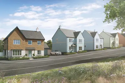
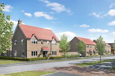
Albany Park by Bovis Homes · Albany Park, Nr Fleet, Church Crookham, Hampshire, GU52 0RE
Bovis Homes has 89 developments on Homello. Homes in Fleet sold for a median £450,000 over the last year, £448 per sq ft; see house prices in Fleet.
About Albany Park
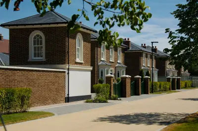
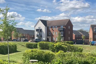
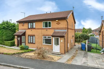
Albany Park, a new build development by Bovis Homes (part of Vistry Group), is situated in the desirable, semi-rural location of Church Crookham, near Fleet, Hampshire (GU52 0RE). The development is nearing completion, offering a final collection of 4 and 5 bedroom new build homes. The current phase primarily features detached and semi-detached properties, targeting family buyers and commuters seeking a balance of connectivity and green space.
Available house types include The Chestnut (4 bedroom semi-detached), The Mulberry (4 bedroom detached), The Yew (5 bedroom detached), and The Lime (5 bedroom detached). All properties at Albany Park are constructed with a focus on energy efficiency, featuring high-quality insulation, enhanced double-glazing, and energy-saving appliances. Select plots include sustainable technology such as solar panels and wastewater heat recovery systems, contributing to a strong Indicative EPC rating of A on some properties. Homes are sold with a 10-year NHBC 'Buildmark' warranty and a 2-year customer care guarantee. Typical property specifications, such as the 4-bedroom detached Mulberry, feature a separate sitting room, a ground floor utility room with outdoor access, and an open-plan kitchen/diner with bi-fold doors leading to the garden. Master bedrooms benefit from an en-suite shower room, and all plots include garage and driveway parking for at least two cars. Prospective buyers should be aware that the developer, Bovis Homes, has faced mixed public feedback concerning after-sales customer service and reported post-completion snagging issues. The Church Crookham area provides a leafy, well-regarded residential environment with strong connections to local infrastructure. Fleet mainline station, situated approximately 2.9 miles away, offers a direct commuter service via South Western Railway to London Waterloo with journey times as fast as 39-52 minutes. The site is positioned for quick access to major road networks, including the nearby M3 motorway, which connects to the M25 and provides routes to Basingstoke, Reading, and London. Local education facilities include the nearby Crookham Church of England Aided Infant School and Church Crookham Junior School, both rated 'Good' by Ofsted. Secondary options, such as Court Moor School and Calthorpe Park School, also hold a 'Good' Ofsted rating. The independent St Nicholas' School (Girls' 3-16) is located on Redfields Lane. For daily needs, a local Co-op provides convenience shopping, while the nearby town of Fleet offers a vibrant high street. The Georgian town of Farnham, approximately 4 miles away, offers a wider range of retail, pubs, restaurants, and a cinema complex. The Albany Park development is in its final phase of sales, and only a limited number of 4 and 5 bedroom properties remain. Interested parties are advised to contact the developer for the latest prices and availability. Viewing arrangements for the show homes can be made directly with Bovis Homes. Contact the sales team for specific details on individual plot features like integrated appliances and EV chargers.
- Developer
- Bovis Homes
- City
- Hampshire
- Neighbourhood
- Church Crookham
- Postcode
- GU52 0RE
- Address
- Albany Park, Nr Fleet, Church Crookham, Hampshire, GU52 0RE
- Bedrooms
- 4–5
- Tenure
- For sale
Questions about Albany Park
›Who is the developer of Albany Park?
Albany Park is a Bovis Homes development in Church Crookham, Hampshire. Bovis Homes has 89 developments listed on Homello.
›What are house prices like in Fleet?
The median sold price in Fleet was £450,000 over the last 12 months (700 sales, −6.3% on the year before), or £448 per square foot, from HM Land Registry data. The house prices in Fleet page has the trend, prices by property type and every street.
›What type of homes are at Albany Park?
Albany Park offers houses, 4–5 bedroom homes. Homes are sold outright by Bovis Homes.
Location
Albany Park, Nr Fleet, Church Crookham, Hampshire, GU52 0RE
Nearest stations
- Fleet Station 2.8 milesSouth Western
- Winchfield Station 3.4 milesSouth Western
- Farnham Station 3.7 milesSouth Western
- Aldershot Station 3.9 milesSouth Western
Nearest schools
- St Nicholas' School 0.2 milesIndependent · ages 3–16
- Crookham Church of England Aided Infant School 0.6 milesPrimary · ages 4–7 Good
- Church Crookham Junior School 0.9 milesPrimary · ages 7–11 Outstanding
- Tweseldown Infant School 0.9 milesPrimary · ages 4–7
Nearest supermarkets
- The Co-operative Food Convenience store 0.1 miles
- Sainsburys Local Convenience store 0.6 miles
- Aldi Supermarket 1.1 miles
- Tesco Express Esso Convenience store 1.2 miles
Eating out nearby
Within half a mile: 2 restaurants and cafes.
- Anchor 0.2 milesRestaurant or cafe
- Redfields Cafe Theatre And Tree Tops 0.3 milesRestaurant or cafe
- Dominos Pizza 0.9 milesTakeaway
- The Verne Fish And Chips 0.9 milesRestaurant or cafe
Straight-line distances; actual routes will be longer. Stations from NaPTAN, with their lines powered by TfL Open Data; schools from the Department for Education register, with the latest Ofsted signal; supermarkets from Geolytix Retail Points; places to eat from the Food Standards Agency's register of food businesses.
Area insights
The Hart neighbourhood around this development.
Sources: HM Land Registry price paid data, Police.uk, Historic England, ONS Census 2021, Ofcom Connected Nations, Environment Agency. Planning offices.

We have not been able to confirm current prices here recently.